Toll Mountain Summit – Big Bend National Park, Texas
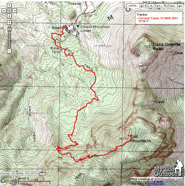
Our first night in the High Chisos Mountains a friend and I decided to bushwhack to the summit of Toll Mountain. At 7415 feet Toll Mountain is the 19th tallest mountain in Texas. That morning we started our hike climbing 1643 feet up the Pinnacles Trail to the saddle between Emory and Toll. We set up our first camp at the TM1 campsite near the bottom of the saddle. Continuing east from our camp we climbed an additional 420 feet to the summit of Toll.
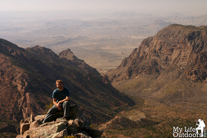
Sitting on top of Toll Mountain
From the TM1 campsite the climb to the top of Toll Mountain is an easy bushwhack. Toll has an average grade on the west slope that is mostly free of trees and thick brush. The hardest part is avoiding the cactus, agave, and other prickly plants as you make your way up the mountain. We did have to backtrack here or there to get around the occasional low tree or thick brush.
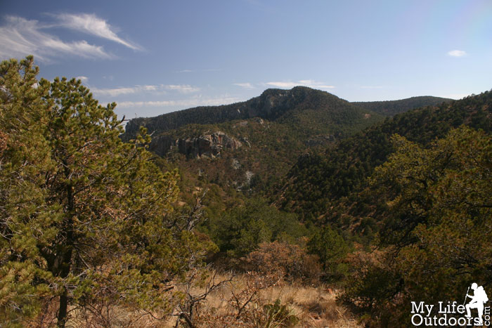
looking toward Boot Canyon from the side of Toll
Boot Canyon
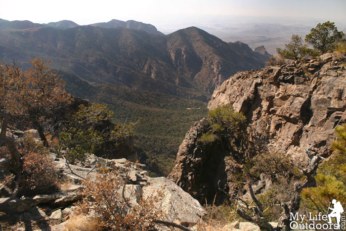
Once we reached the top we made our way over to the mountains northern edge. The top of toll is a mostly flat half circle that gently fades to a shallow southern facing bowl. All along the north edge thick trees seemed to hinder the best views of the basin. We continued bushwhacking east till we came to a clearing and a small rock outcropping high above the basin. The views were beyond stunning. I couldn’t resist the urge to venture out onto the rock outcropping. With 500 to 1,000 foot drops on all sides I slowly made my way to the edge of the small rock and sat down. This, it seemed, was the top of the world. I pondered how such experiences never get old…how I could climb to thousand similar locations and never cease to be amazed.
Thick trees along Toll’s northern edge,
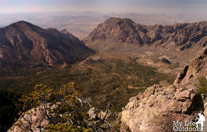
Chisos Basin from Toll Mountain
Sitting on the small rock outcropping
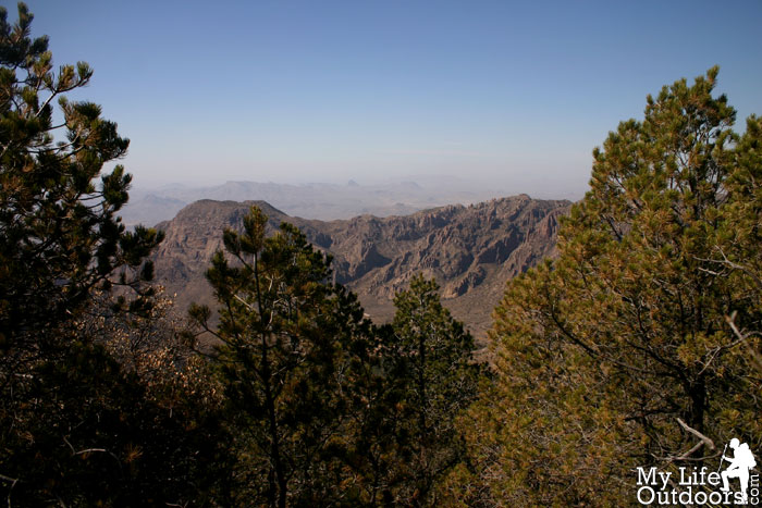
Looking West from the top of Toll Mountain
Chisos Basin view from Toll Mountain
Looking West from Toll Mountain
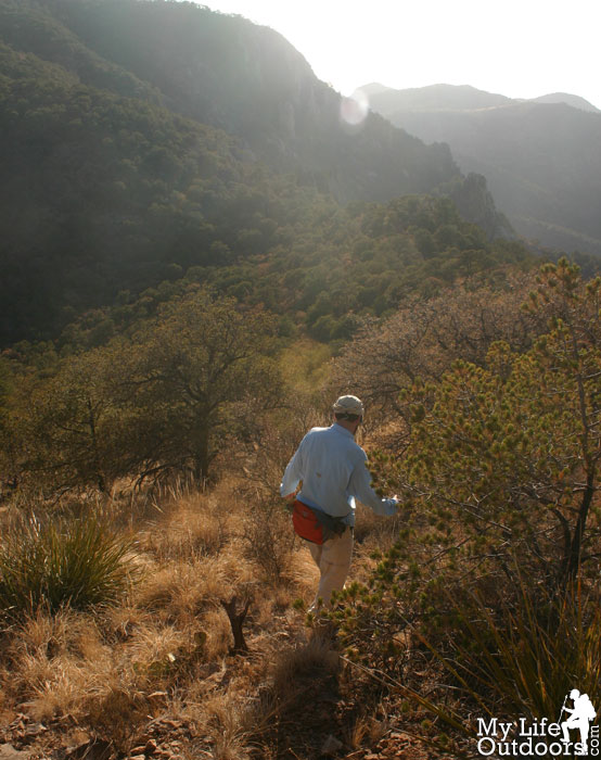
We continued around the edge of toll eventually reaching the saddle between Toll and Casa Grande. From here a whole new set of views opened up with Juniper Canyon sprawling below us. We gazed over at Crown Mountain and The Sierra Del Carmen in the distance as we sat on the edge of the cliff dangling our feet high above Juniper canyon. We must have sat for close to an hour enjoying the gentle breeze and amazing views. Before long, sunset threatened to force us to descend Toll in the dark. We made our way back to the West slowly bushwhacking toward camp.
Looking along the Saddle between Toll and Casa Grande
Casa Grande
Crown Mountain
Crown Mountain above Juniper Canyon
Heading down to our campsite
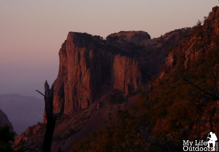
Sunset on Casa Grande
The decent was much trickier then the climb but nothing we couldn’t handle. With just minutes left before dark we reached our campsite. The Summit gave us a great since of accomplishment. We wondered how many, or how few had ever stood were we had that day.
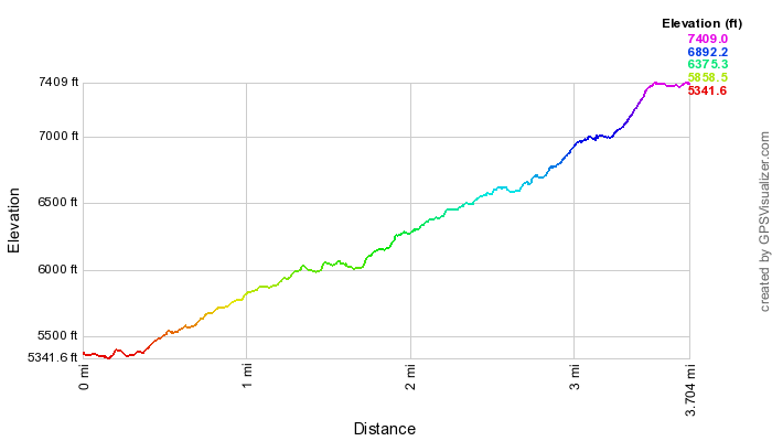
The Hike: 3.5 mile hike one way plus 1 mile bushwhack one way Starting Elevation: 5352 feet Ending Elevation: 7415 feet Elevation gain: 2063 feet
Resources: I use both the Map and Book featured below when planning my trips to Big Bend. I highly remomend them to anyone wishing to hike there. Buy them through these links and help support MyLifeOutdoors.
Great report Steven. The views are definitely breathtaking. I guess if we ever make it to Texas for hiking, it will have to be in the winter. I don't know if we could handle the heat once summer got there. Maybe if I were 18 again like I did riding The Hotter Than Hell 100. That was a blast.
Jutain Mercado
January 31, 2012
I love your reports! I will be doing this one and Casa Grande this week. Can't decide whether to bushwack up the trail to Casa Grande or go the Lost Mine Trail route. Definitely looking for the least technically demanding route as I am not versed on protection on these rocks!
Thanks for reading. I have never been up to Casa Grande, although it is on my list. From what people tell me I think the Lost Mine Trail is probably the least technical. If you haven't been there already go check out BigBendChat.com. There are plenty of people there who can tell you the best/safest way to go.


Brasil
How great the feeling to be on top of the mountain,Climbing is a tough thing to do I salute the climbers in the world.
Griffis Family
I had always wanted to bag that peak and unfortunately never did. Nice trail report.
Tim @ Appalachia and Beyond
Great report Steven. The views are definitely breathtaking. I guess if we ever make it to Texas for hiking, it will have to be in the winter. I don't know if we could handle the heat once summer got there. Maybe if I were 18 again like I did riding The Hotter Than Hell 100. That was a blast.
Jutain Mercado
I love your reports! I will be doing this one and Casa Grande this week. Can't decide whether to bushwack up the trail to Casa Grande or go the Lost Mine Trail route. Definitely looking for the least technically demanding route as I am not versed on protection on these rocks!
Steven Smith
Thanks for reading. I have never been up to Casa Grande, although it is on my list. From what people tell me I think the Lost Mine Trail is probably the least technical. If you haven't been there already go check out BigBendChat.com. There are plenty of people there who can tell you the best/safest way to go.