On Thursday October 21st I hiked to the Summit of Hunter peak in the Guadalupe Mountains National park. At 8,368 feet Hunter Peak is the fourth highest mountain in Texas. I had come to the Guadalupe’s for a long planed backpacking trip through the heart of the mountain range. I arrived a day early to ensure my group could reserve the necessary backcountry sites needed to complete our hike. (The Guadalupe’s are a popular place in the fall). Having acquired the necessary permits and reservations I had the rest of the day to wait for my friends to arrive.
 |
| El Capitan and Guadalupe Peak in the clouds. |
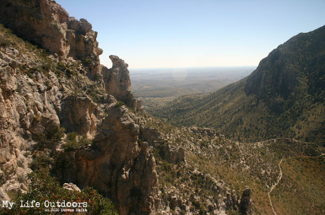
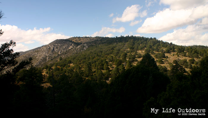
With time to kill I decided to take a “little” warm up hike up to the summit of Hunter Peak. There are two trails to the top of Hunter Peak. One trail is the Tejas trail that my friends and I would take the next morning on our way to McKittrick Canyon. The other trail is up Bear Canyon. Anticipating a heavy pack the next day I decided to space out the weight and hike up most of my water (18 pounds) to the top of the Tejas Trail. I packed a lunch two days worth of water and headed up the Tejas trail. With hardly any wind that Thursday was a very unusual day in Guadaulpes. I hiked alone enjoying the beautiful views of Pine Springs Canyon.
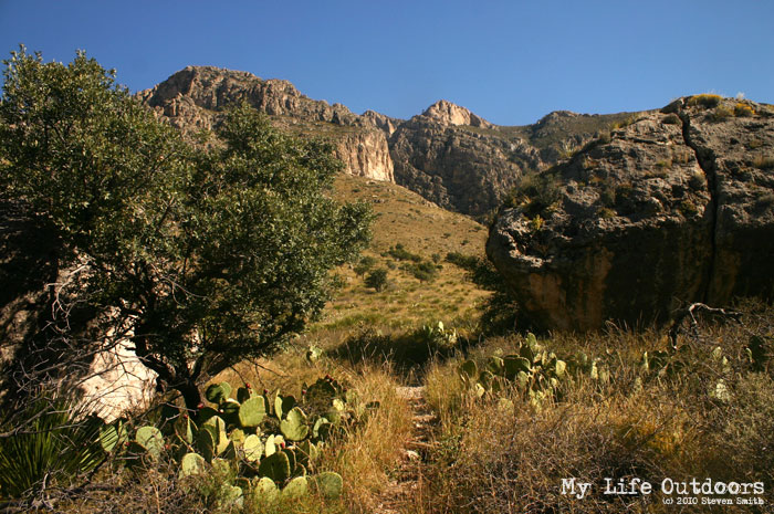
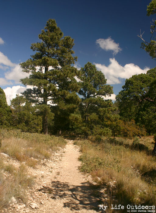
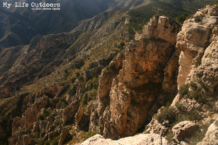
When I reached the top of the Tejas trail I was amazed at the difference in ecosystems. Most of the Pine Springs valley and the Tejas trail, up to this point, is arid desert mountains. Once you reach the northern rim of pine springs canyon the Tejas trail enters into an area called “Pine Top”. From here stretching out miles to the north is a thick forest of Ponderosa and Pinyon Pine, Bigtooth Maple, and Grey Oak trees. Creating a “sky island” these trees are only found in the higher elevations, canyons, and riparian areas of the Guadalupe Mountains.
 |
| On the Tejas Trail looking up toward the south rim of Pine Springs |
 |
| Pine Springs Canyon as viewed from the Tejas Trail |
 |
| View to the East from the Tejas Trail |
 |
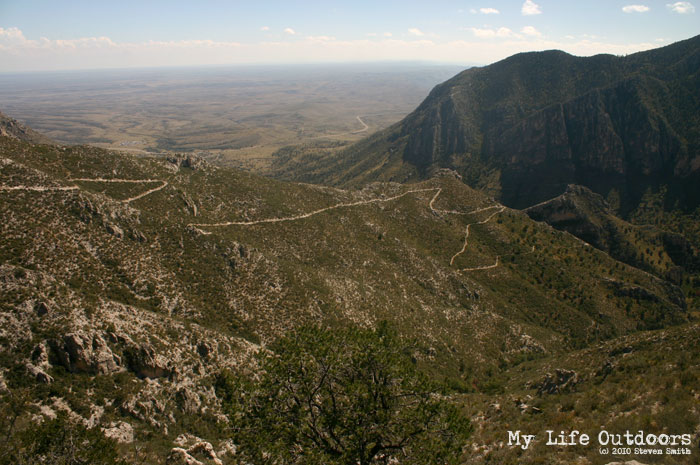
| Tejas Trail snaking down into the valley |
 |
| The first trees in 3.6 miles of Tejas Trail. This is the entente to the “Sky Island.” |
|
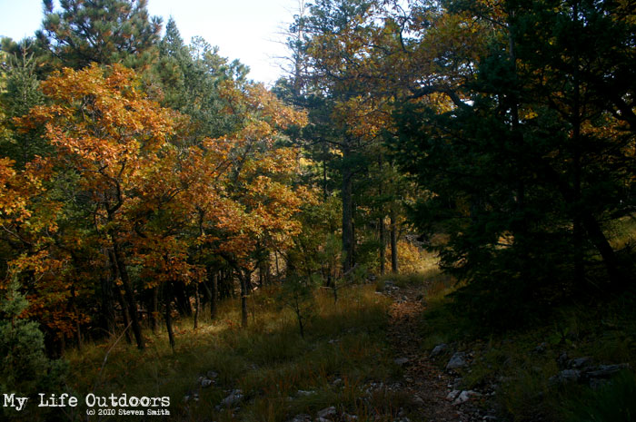
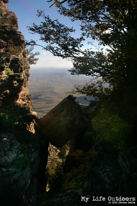
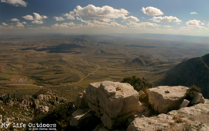
I looked around for a suitable place to stash my water till the next day. I bushwhacked about 20 yards off trail and hid my water in an old hallowed out tree. I sat down and ate lunch while I enjoyed the beautiful yellows of the Oaks and Maples. The next day my friends and I would continue north along the Tejas trail eventually camping at the Tejas Backcountry campsite. Today, however, I would take the Bowl Trail East to Hunter Peak. The next mile to the Summit of Hunter Peak continued along the southern edge of the forest. As you approach the summit the trees open up to outstanding views of Guadalupe Peak (8749 feet, Highest in Texas). I found a summit marker labeled “Pine Top” placed there in 1949. I took in the views of the desert floor to the east, a far off view of McKittrick canyon to the north, Guadalupe to the south, and Bush Mountain (8631 feet, second highest in Texas) to the west. Tired from my hike I laid down on a slap of rock next to the summit marker and inadvertency fell asleep. I woke up hungry, unsure how long I slept. I knew it was time to get down and cook dinner.
 |
| Pine Top viewed from the Bowl Trail |
 |
| Fall Colors on the Bowl Trail |
 |
| Fall Colors on the Bowl Trail |
 |
| A view to the east just below the summit |
 |
| Hunter Peak Summit Marker |
|
 |
| View from the summit |
 |
| Looking down |
 |
| Guadalupe (left) and Shumard (right) as viewed from Hunter Peak |
 |
| McKittrick Canyon in the far North |
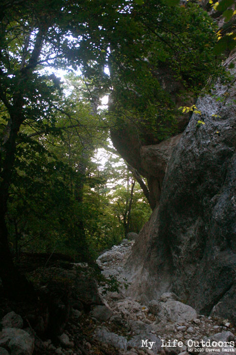
I continued east along the bowl trail eventually meeting up with Bear Canyon. Bear Canyon was an unexpectedly pleasant canyon. From the top it looked plain and monotonous with switchbacks all the way down. As I got deeper into the canyon I began to pass through some more colorful trees as well as tight canyon walls. Some of the rocks were stacked on top of one another creating little “caves” were the trail passed through. I caught myself enjoying the hike through Bear Canyon more than the Tejas route I took up. Once I reached the bottom of the canyon I ran into a single mule deer that jumped out in front of me on the trail. She was all alone and quickly disappeared among the desert shrub brush. The reminder of my hike back to base camp followed the Frejole Trail before ultimately linking back up with where I started on the Tejas trail.
 |
| Looking down Bear Canyon |
|
 |
| Bear Canyon Trail |
 |
| Bear Canyon Trail |
 |
| Bear Canyon Trail |
 |
| Bear Canyon Trail |
 |
| A cave like passage on the Bear Canyon trail |
When it was all said and done I had hiked for about six to seven hours (including lunch and a small nap) and had traveled close to nine miles. During the last two miles my legs and feet began to tremble and shake with every step. I worried I had pushed myself too hard the day before a big trip. My legs proved to be alright over the next three days. I ended up the straggler on our big trip with everyone commenting how “smart” It was of me to “warm Up” before the big hike. They can say what they want…I had a great time on Hunter Peak.
The Hike:
8.7 Mile loop
Trail-head: Pine Springs Trail-head
Starting Elvation: 5,734 feet
Highest Elevation: 8,368 feet
Elevation Gain: 2,634 feet
Resources:
I use both the Map and Guide book featured below when planning my many trips to the Guadalupe Mountains. I highly recommend them to anyone wishing to hike there. Purchase them through these links and help support MyLifeOutdoors.


Karl
Hey Steven,
This looked like a great hike. At 8,368', it being the sixth highest in Texas, is still higher than our tallest peak, Mount Washington at 6,288 up here in New Hampshire.
The landscapes of the two states are so different. I would love to hike down there some day…really looks beautiful.
Great Trail Report of Hunter Peak!
Karl
Steven
Karl,
Thanks for stopping by. We may have taller mountains but most of them are desert mountains which makes finding water a problem. I'm sure your NH mountains are much weter.
like you I would love to be able to hike in NH someday. I look forward to reading your blog.
Mark S.
Great hike! I've done it several times myself.I also highly recommend the bush mountain trail continuing on to dog canyon. Looking forward to my next trip now!
Atom
Pretty cool looking hike. I haven't been to the scenic parts of Texas. It's nice to see some good exploring and quality photos from that part of the country.