Mount Livermore – Summit Hike – Davis Mountain Preserve, Texas
Last weekend the family and I headed back to Mount Livermore to see if we couldn’t make it to the summit this time. If you have been following the blog then you know our last attempt was plagued by thunderstorms. This weekend was the exact opposite. Saturday turned out to be a beautiful day and my family took advantage of yet another open weekend at The Nature Conservancy’s Davis Mountain Preserve.
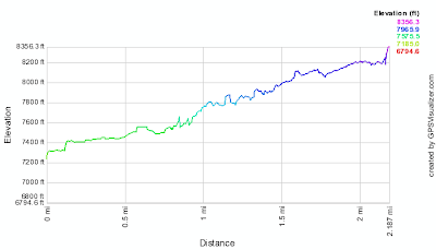
Once again we drove the 6.63 miles and 1,208 feet from the McIvor Visitor Center to Bridge Gap via the very rough and steep Madera Canyon Road. We had received special permission to pass the cable gate (which has since become a pipe gate) and were permitted to park a Bridge Gap. If you attempt this hike yourself it is likely you will have to park your car and start to hike at the pipe gate. Only 4wd vehicles are permitted past the pipe gate (for good reason) and only with permission. From the Pipe gate the hike to the summit is just less than 5 miles (one way) and climbs approximately 2,000 feet to the summit.
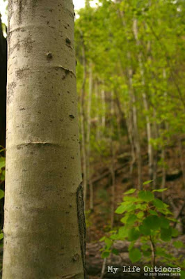
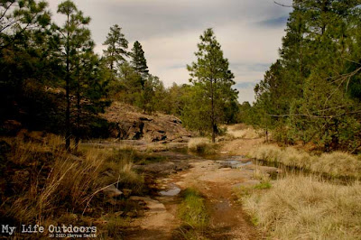
At Bridge Gap you have a choice. Continue to hike along the Jeep road (which is no longer used due to its steep grade) or follow the Limpia Chute trail. We chose the Limpia Chute trail which passes near a small grove of Aspen Trees in Limpia Canyon. I am told this is the southernmost grove of aspen trees in the United States. Unlike last time, the aspens had bright green leaves and really stood out among the surrounding pine trees. You could see the grove from several hundred yards down the mountain.
After about a mile the Limpia chute trail rejoins the old Jeep road. Follow the jeep road all the way to the base of Baldy Peak. Baldy peak is the highest protruding rock atop mount Livermore. The last 100 feet is a near vertical scramble to the top. There is quite a bit of exposure and can be scary at times (especially for a 9 year old).
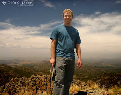
At the summit there are outstanding views in all directions. Baldy is the highest peak for 100’s of miles. It is the 5th highest mountain in the state and the highest in the Davis Mountain Range. The next highest mountain in the vicinity is 598 feet below Baldy (Brooks Mountain at 7,780). With all this combined you get a sensation of being on top of the world with nothing else even approaching your altitude. My Daughter and I took in the views, posed for pictures, and then began the decent down to Bridge Gap.
Getting There:
McIvor Visitor Center is located at 30.700580º N 104.115704º W
The Pipe gate is located at 30.657793° N 104.167283° W
Bridge Gap is located at 30.642821° N 104.162671° W
The Summit is located at 30.635503º N 104.173361º W
More more information about Summiting Mount Livermore, including maps please see my previous Livermore Post.
Sorry, the comment form is closed at this time.


San Antonio Hotel
Hey Mate,
I really like concept of your post, i hope that you have really done good home work before posting that kind of post.
Thanks
San Antonio Hotel
Steven
Thank San Antonio Hotel. I try to do all the research i can before I post. I hope it will be useful to someone else in the future.
CC
How long did it take you to hike the Livermore trail? I'm taking some middle school students there and wanted a rough estimate. Thanks!