This is part two of our 4 day hike in the Pecos Wilderness – New Mexico. Read Part One – Hiking to Lake Johnson.
My heart is pounding, my feet ache, and I’m starting to doubt there is a lake up here at all. We feel like we have been hiking all day and the constant incline of the trail seems as if it will never let up. But just as we begin to think we should camp for the night…Lake Katharine comes into view, and she is amazing.
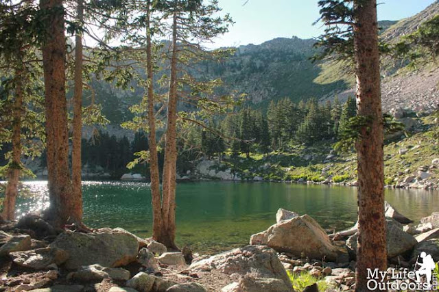 |
| Lake Katharine – Pecos Wilderness NM |
That morning we broke camp and left Lake Johnson behind. During the hike we would descend nearly 900 feet only to go back up another 1500 feet. It would be a tough but rewarding day as we would see two more Sub Alpine lakes. Lake Stewart and Lake Katharine.
 |
| Hiking along the SkyLine Trail (#251) Pecos Wilderness |
We started down Skyline Trail (#251) toward Lake Stewart. Going down always seems easy and we traveled the 3 miles in no time arriving at the lake by mid morning. We had some friends who hiked in with us the day before but didn’t feel up to the climb that was Lake Johnson’s. Instead the pushed ahead to Lake Stewart and had spent the night there. We stopped for awhile and visited with them as they fished in low alpine lake.
 |
| SkyLine Trail #251 Pecos Wilderness NM |
Looking out across Lake Stewart we could see Santa Fe Baldy and the small bowl that hid Lake Katharine. Thats were we would be spending the night tonight. She was calling us, so we said goodbye to our friends and continued down trail 251 to the Winsor Trail Junction. Throughout most of this section the trail is relatively flat between the Winsor and the Lake Johnson Junction.
 |
| Small pond just before lake Stewart |
 |
| Lake Stewart with Santa Fe Baldy high above. |
At the Winsor Junction Trial 251 turns west and begins the steep climb up to Lake Katharine. In a little less than a mile the trail climbs most of the 1500 foot rise. We started off strong excited about the promised beauty of Lake Katharine. As we arrived at the next Junction we began to worry. The Forrest Service map was not lining up with what we were seeing on the GPS. We were tuckered out after climbing up a steep trail only to worry it was the wrong way. The trail we were on was not on any maps except my GPS. We discussed going back and looking for the trail on the Forest Service Map. No one wanted to loose elevation we had already gained. So we decided to carry on down the mystery trail. If my GPS was right it would eventually lead us to Lake Katharine.
 |
| Water Crossing along SkyLine Trail 251 – Pecos Wilderness NM |
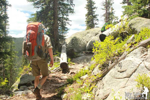 |
| Hiking toward Lake Katharine – SkyLine Trail Pecos Wilderness NM |
As it turns out the Forest Service changed the trails but never changed the map. The only way to know the difference was by GPS or really good orienteering skills. When we left Lake Katharine later that week we decided to try the old trail. It was a mistake. The forest service abandoned it long ago evidenced by the massive number of downed trees. If you head to lake Katharine follow the signs for Trail 251, you will save your self a lot of effort.
 |
| When you see this sign be sure to take the SkyLine Trail (#251). The Forest Service Map will make it look like you can get there along Winsor Trail 254. Don’t go that way. |
As we began to near the lake basin fatigue had really set in. The climb had completely worn us out and we were beginning to wonder if we would ever get there. Just before the Lake a small pond appears on the right side of the trail. The pond seemed so inviting and required no more climbing. We thought about just camping there so we wouldn’t have to keep going. Later we discovered there was a couple camped by the pond. They thought it was lake Katharine and set up camp on the shore. We told them they were in for a surprise. Just around the corner was the real lake Katharine. One of the prettiest sub-alpine lakes I have ever had the pleasure of viewing.
 |
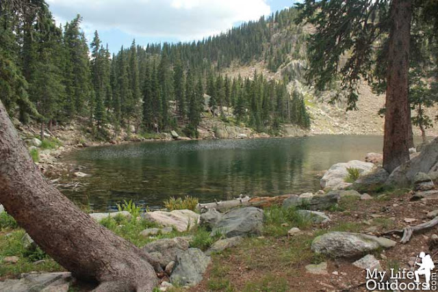
| Small Pond below Lake Katharine – Pecos Wilderness NM |
 |
| Small Pond below Lake Katharine – Pecos Wilderness NM |
When we finally arrived at Katharine we were so tired we unstrapped the packs and set up camp in the first level spot we could find. After we rested a short bit we hiked around the back side of the lake. We should have kept going. The best campsites were around to the west end of the lake.
 |
| Arriving at Lake Katharine – Pecos Wilderness NM |
 |
| Lake Katharine – Pecos Wilderness NM |
 |
| Lake Katharine – Pecos Wilderness NM |
 |
| Lake Katharine – Pecos Wilderness NM |
 |
| Our Campsite right next to the lake |
 |
| One of the most disgusting meals I have ever eaten. |
 |
| Campsite Visitor begging for food |
We spent the afternoon taking in the beauty of the lake. We were the only ones there (for now) and we were enjoying nature at her best. The next day we would summit Santa Fe Baldy and see a whole new side of Katharine But that is another story for another time.
 |
| Lake Katharine – Pecos Wilderness NM |
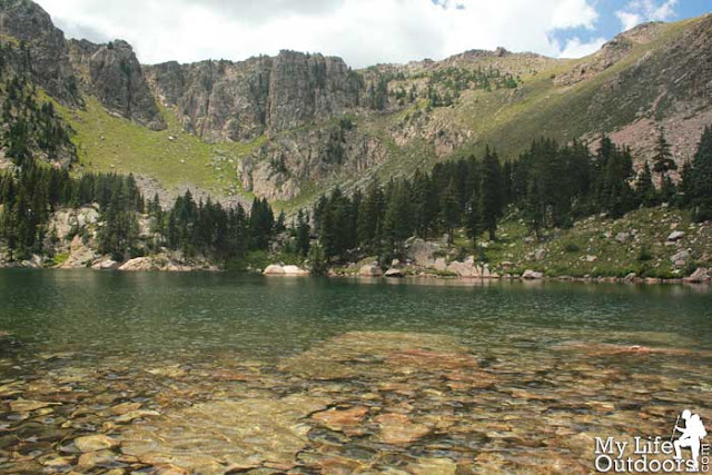 |
| Lake Katharine – Pecos Wilderness NM |
 |
| Lake Katharine – Pecos Wilderness NM |
 |
| High Alpine Meadow behind Lake Katharine. |
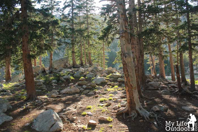 |
| Sun coming through the trees at our campsite. |
Read about the first part of this hike – Hiking to Lake Johnson
The Hike:
Starting Elevation: 11,091 Feet
Mid-Point Elevation: 10,232 Feet
Ending Elevation: 11, 742
Elevation Change: Down 859 feet, Up 1510 feet
Distance: 6.4 miles
Getting There:
Lake Johnson: 35°51’16.67″N 105°44’9.28″W
Lake Stewart: 35°49’52.72″N 105°43’27.36″W
Lake Katharine: 35°50’4.73″N 105°45’1.97″W
 |
Lake Johnson to lake Katharine – Pecos Wilderness NM.
You can see where our route differs from the mapped trail leading up to lake katharine. |
 |
| Elevation Profile Lake Johnson to Lake Katharine – Pecos Wilderness NM |
Resources:
Did you like this post? Please share it with your friends!
Tweet
35.9771777-105.7591448


Andy
Great report. This looks awesome! Thanks.
Linda Williams
Yes, it is a very pretty place. Well worth the trouble to get there!
Steven Smith
Thanks for reading Andy.
Steven Smith
I take it you have been there before? I want to go back and take my wife.
Susan
What a great hike. Good job. Love reading about your travels.
Susan
http://travelbug-susan.blogspot.com
Misti @oceanicwilderness.com
"The pond seemed so inviting and required no more climbing."—oh, I know those moments!
Looks like a great area to explore, will have to put it on my 'list' of places to visit.
Steven Smith
Sometimes I wonder if I'm a hardcore Hiker/Backpacker. I tend to have those types of thoughts a lot.
BethWagenius
Beautiful! So worth the hike to see these kind of places.
I take it you're not recommending the chicken and beans?!! 🙂
Steven Smith
I took that picture thinking I would review the meal here on the blog. After eating it I decided I would save AlpineAire the embarrassment of a full review. So No I don't recommend them. Being from Texas I hate that it even carries my wonderful states name.
Grayson Ridge
Excellent post! I'm very interested in making this trip. What are the crowds like? Is it a well known spot or relatively secluded? What is the best time of the summer to go?
Steven Smith
Lake Katharine is a very well known and easily accessed lake (relatively). This makes it very popular for dayhikers coming in from the Ski Santa Fe area (which is not the way we came). If you spend the night take the extra time to circle around to the backside of the lake. You will be glad you did.
The lake is large enough that at night you can feel relatively secluded even if someone else is camping nearby. The Only exception is loud or obnoxious campers. We had a group of young 19-20 year olds pack in a lot of booze and camp on the other side of the lake. The sound of them partying carried across the water all night causing us to pack out a day early.
As far as time of year. I have only been in August. I would recommend going in the middle of the week if you wish to avoid crowds. Even then you are likely to run across one or two groups on the trail or at the lake. Katharine is popular for a reason. She is stunning.
Steven Smith
I thougth I should add. The crowds are relative. Compared to a place like Yosemite or Yellowstone the crowds here are non existent.
Nate
Just curious, how many minutes of hiking was it from the pond to Lake Katherine? Some friends and I went on a hike with the goal of hitting Lake Katherine. Unfortunately we were so tired from getting lost for about an hour that we set up camp at that pond since the sun was setting in about 30 minutes.
Nate
Also, a lot of times I find myself not caring what I eat when I'm long distance hiking, but I tried out some rice mix at home before bringing it on a camping trip, and I am sure glad I did. One of the worst things I've ever eaten, and I've eaten some gross things.
Sarah Richter
Is a GPS device necessary? The comments that you made about the GPS unit and trial map not agreeing have me a little concerned. We have the map that you recommend having, and were kind of hoping that the trails would be evident/well-marked.
GNA HIKE N SKI 4EVER
WOW awesome pics! We hiked in from ski basin a couple of weeks ago stopped at the split to summit and lake k as it was only a day hike as it got pretty late pretty fast! Think Im gonna try a persuade the wife to go to Pecos in the am and see if we can reach Lake Stewart. Wish us luck…… monsoon season….. will let you know how far we get.
steve ricci
Im planning a trip next May/June with my son, looks awsome
Kim
This is a beautiful post. We are going there next weekend and plan to hike in from Winsor Creek TH to Stewart Lake, camp there and finish hike to Katherine the next morning. Wish my 55-year-old knees luck, what a destination though! Glad you are representing Texas so well.
servinc
fell in love with backpacking in the Pecos Wilderness in 1971. Golly these photos make me wanna weep with longing. God is so good and the beauty of raw nature is so very poignant. Thanks for the posting,
servinc
get a good topo map and learn to read it.
Andrew
Can you hike the Pecos in mid May? or is it too cold and wet?
malia
hi there,
do you think lake katherine would be frozen in early may? my boyfriend and I are planning a backpacking trip for my birthday… we like to do cold plunges & want to jump in the lake, but this won’t be possible if it is frozen. thanks.
stevensmith
No I don’t believe it will be frozen, but there will be large snow banks around the lake and most the way up.